Emergency Notification for 01/11 – 12/20
I just received this notification from Jackson County Emergency Management. Please share this as widely as possible.
Good afternoon,
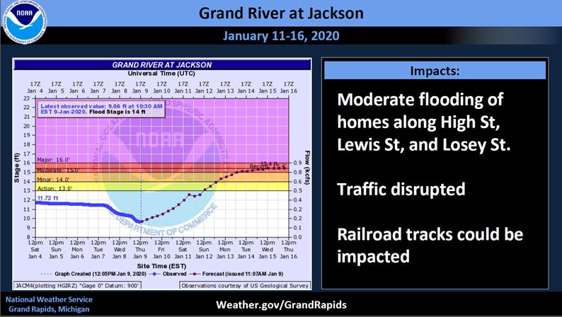
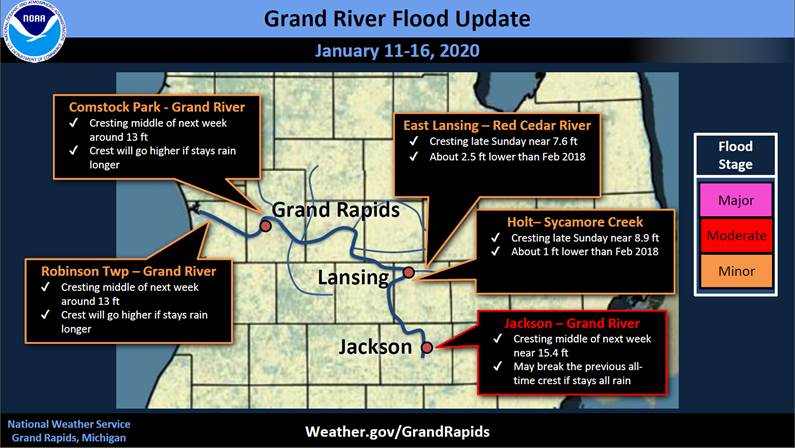
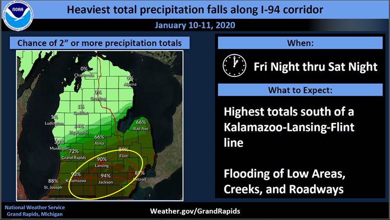
After speaking with National Weather Service Representatives (NWS) today, I wanted share some important information with each of you. Jackson County is projected to receive extreme amounts of rain starting tomorrow afternoon/evening. Due to higher than average water levels, lakes, streams and rivers are already at capacity. NWS is projecting Jackson will receive 3-5” of rain by Sunday with the majority falling Saturday. This will result in unprecedented flooding of the Grand River. The downtown area could see flash flooding due to the heavy rainfall. The river is expected to crest next Wednesday (15th) and projected to be the highest level in history. I encourage each of you to plan accordingly and share this information with family, friends and neighbors. Please be prepared for potential disruption of business and services for those areas along the Grand River.
An additional area of concern is the potential for freezing rain during this storm. The ice, plus wind predictions of 30-50 mph will likely result in large spread power outages.
I’ll update you tomorrow afternoon with additional information.
Thank you,
Jason M. Breining, Director, P.E.M.
Jackson County Office of Emergency Management & Homeland Security
1715 Lansing Ave.
Jackson, MI 49202
517-768-7946 Office
517-740-5813 Cell
[email protected]
www.mijackson.org